current bid on this item. The bidding increment
is determined by the amount of the current bid.
The table below explains how bid increments
are calculated.
| Low | High | Increment |
|---|---|---|
| $0.01 | $10.00 | $1.00 |
| $10.01 | $25.00 | $2.00 |
| $25.01 | $100.00 | $5.00 |
| $100.01 | $500.00 | $10.00 |
| $500.01 | $1,000.00 | $25.00 |
| $1,000.01 | $5,000.00 | $50.00 |
| $5,000.01 | $10,000.00 | $100.00 |
| $10,000.01 | $25,000.00 | $250.00 |
| $25,000.01 | $50,000.00 | $500.00 |
| $50,000.01 | $100,000.00 | $1,000.00 |
| $100,000.01 | $250,000.00 | $2,500.00 |
| $250,000.01 | $500,000.00 | $5,000.00 |
| $500,000.01 | $1,000,000.00 | $10,000.00 |
| $1,000,000.01 | $2,000,000.00 | $20,000.00 |
| $2,000,000.01 | $99,999,999.00 | $50,000.00 |
Art Deco Living Estate in Arlington, VA - PART 3
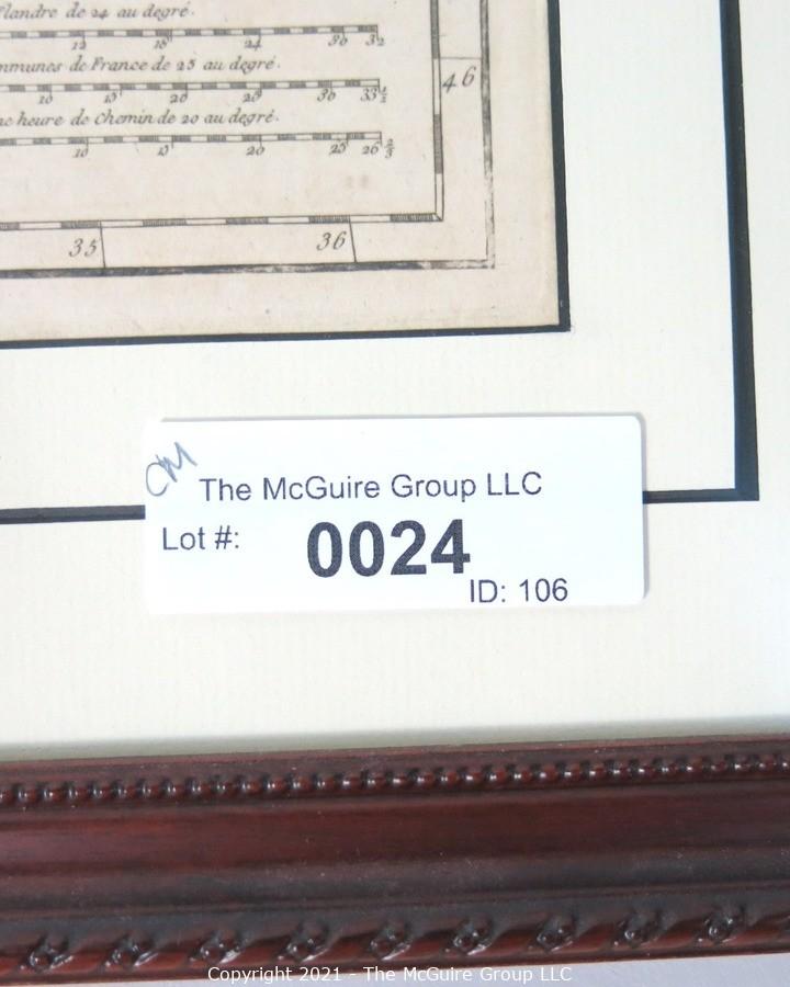
viewing lot number 0024
Inspection: Available by appointment. Please contact us.
Your credit card will automatically be charged at the conclusion of the auction. If you are tax exempt, PLEASE contact David BEFORE you bid, otherwise you will be charged. 202-441-5446
Location: 148 Hillwood Ave., Falls Church, VA 22046. The cross Street is Douglass.
Removal Time: Saturday, February 20, 12-2pm ET
DISCLAIMER:
The McGuire Group, LLC encourages all bidders to inspect lots in person before bidding. The McGuire Group, LLC is not responsible for incorrect listing information, if any. The McGuire Group, LLC has attempted to provide accurate descriptions of all items, however, it is the bidders responsibility to determine the condition and suitability of each lot. Printed statements or descriptions by The McGuire Group, LLC staff are provided in good faith and are matters of opinion.
BIDDING MISTAKES:
Review all bids before submitting. Our clients are not willing to reimburse you for mistakes of judgment as to suitability of the items you bid on.
CATALOG DISCREPANCIES:
When in doubt, contact us before bidding.
PHOTOS:
Photos often show more than one item; or several items connected. Do not assume anything simply because the items appear to be photographed together.
AUCTIONEER RIGHTS:
The McGuire Group reserves the right to add or remove items, split or combine lots, cancel, extend or reschedule individual items or events, and make changes to inspection and removal times.
Consignors may, on occasion, place minimum acceptable prices on items.
NO RETURNS OR CREDIT CARD CHARGE-BACKS
All sales are final. There are no returns, refunds or credit card chargebacks or adjustments
PAYMENT
If you are the high bidder for an item at the end of the auction, your credit card on file will be charged and you will receive an invoice that you can print and bring to the removal site at the stated time to retrieve your merchandise. All items not removed during this time will be considered abandoned property and The McGuire Group, LLC reserves the right to resell the items and retain all sales proceeds as payment for accumulated unpaid storage and handling.
SHIPPING:
The McGuire Group provides packing and shipping services for non-breakable purchases under 30 lbs. If you require shipping of purchases outside our limits, we offer a list of recommended third party shippers. It is the responsibility of each purchaser to make their own shipping arrangements, and we ask that you notify us of your shipping arrangements by email (david@themcguiregroupllc.com) so that we release items to the correct agency. We may charge a $5 per day storage fee for items that are not picked up at the posted removal time.
The McGuire Group is not responsible for any actions or omissions of carriers or packers whether or not recommended by us.
Local delivery:
Bungii On-Demand Local Delivery
PHONE: Randy Sullivan, 443-676-3679
E-mail: phyresyde1978@gmail.com
For Pickup, Packing and Delivery out of area:
The UPS Store 3141
PHONE: 703-533-9474
E-mail: store3141@theupsstore.com (Bert)
Navis Pack and Ship (Will ship all sizes and values)
PHONE: 410-737-8020
E-mail: md1075@gonavis.com
https://www.gonavis.com
There is no holding of merchandise for this auction. Your only opportunity to remove your purchases in person is at the stated removal time. (202) 441 5446. If you know of a conflict in advance, call us.
DISPUTES AND DEBT COLLECTION;
Any dispute arising out of this contract in an amount less than $5000 is to be settled in Small Claims Court. Disputes over $5,000 will be resolved in accordance with the Commercial Arbitration Rules of the American Arbitration Association. In both cases, the venue will be the County of Fairfax, Commonwealth of Virginia. As for debt collection, the bidder agrees that a fee of 2% of the outstanding balance per month will be added to any unpaid balance due The McGuire Group, LLC.
GUARANTY AGREEMENT:
By submitting a bid in the name of a business entity, the individual submitting the bid enters into a guaranty whereby he or she personally guarantees payment to The McGuire Group, LLC of any bid amount not paid by the business entity or corporation for any reason, together with all collection expenses incurred to enforce collection.
LIMITATION OF LIABILITY:
If, for any reason, The McGuire Group, LLC is unable to make available or deliver any purchase, or portion thereof, or documentation required in respect of any purchase, the sole liability of The McGuire Group, LLC if any, shall be the return of monies paid in respect of such purpose upon its return by the purchaser.
AGE REQUIREMENT:
All bidders must be 18 years of age or older.
BIDDER INFORMATION AND SECURITY:
All registration information the bidder provides to The McGuire Group, LLC shall be current, complete, and accurate. All bidders are responsible for any bids placed under their bidding numbers and passwords. The security of bidder information is the responsibility of the bidder. Bidders must notify The McGuire Group, LLC if they believe that their bidder number and password have been compromised.
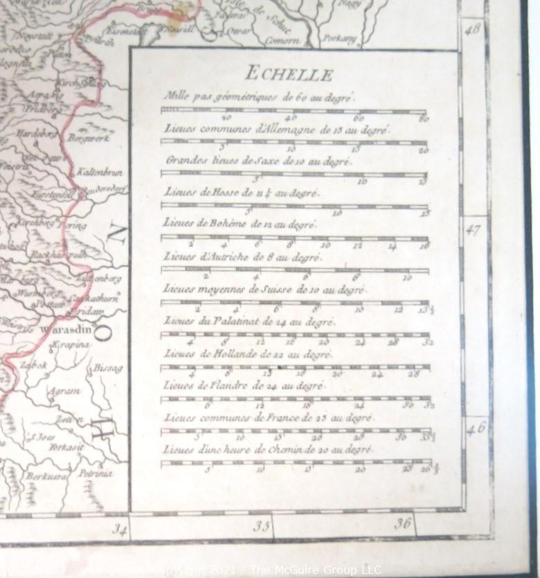
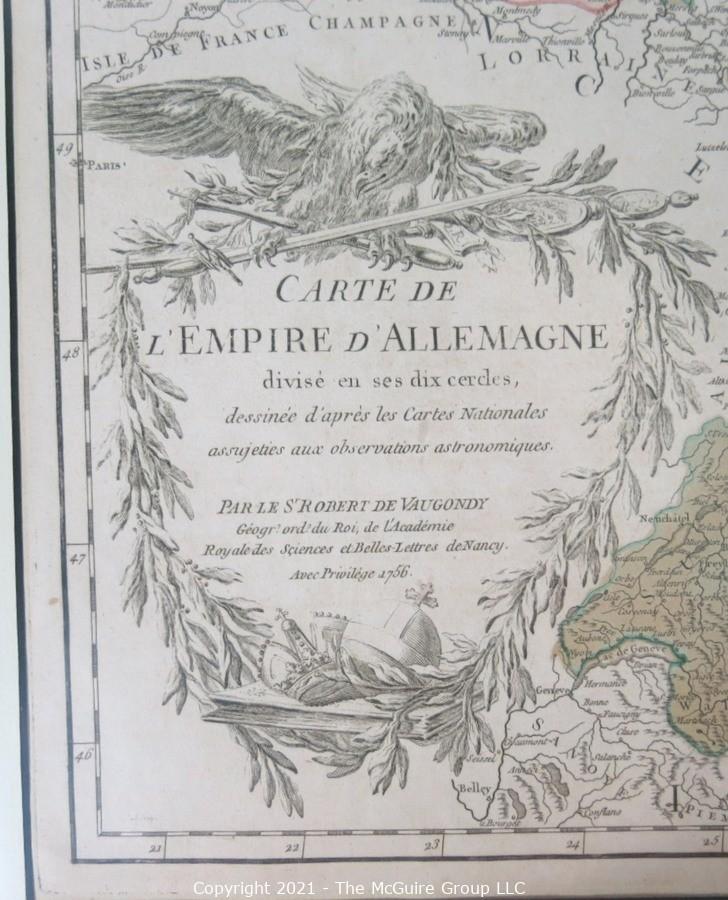
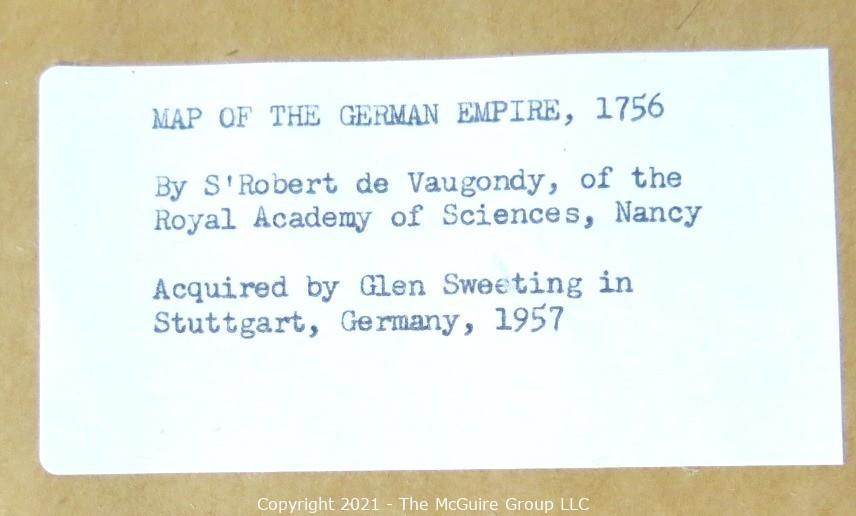
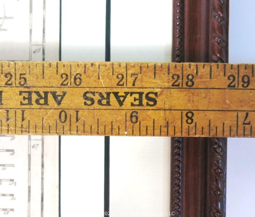
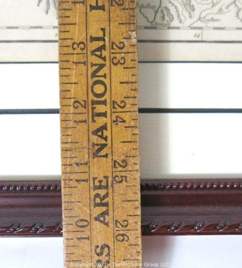
Lot #0024: 1756 Framed Antique Map of the German Empire By Leading French Cartographer Gilles Robert de Vaugondy of the Royal Academy of Sciences, Nancy. Outside Dimensions 26W x 29"T
Bidding is not allowed on this item at the moment.
| Current Bid: | ||
|---|---|---|
| NA | ||
| Tax: | Falls Church, VA | |
| Time Remaining: |
{{item.end_time | durationWords: current_time}}
(bidding was extended)

|
Closed |
| Bidding Ends: | Thu, Feb 18 9:22:00 pm ET | |
| Bidding Ended: | Thu, Feb 18 9:22:00 pm ET | |
| Status: | {{item.bid_status_text}} | |
| High Bidder: | {{crowd_bidder && crowd_bidder == item.high_bidder ? crowd_bidder_username : item.highbidder_username}} | |
|
Bid Increment:
|
||
| Reserve Price: | ||
| Starting Bid: | ||
| Item Location: | ||
| Seller: | {{item.seller_user_name}} | |
| Item has been viewed 1,423 times. | ||
 PREV LOT
 RETURN TO LIST
 ASK ABOUT THIS ITEM
| Low | High | Increment |
|---|---|---|
| $0.01 | $10.00 | $1.00 |
| $10.01 | $25.00 | $2.00 |
| $25.01 | $100.00 | $5.00 |
| $100.01 | $500.00 | $10.00 |
| $500.01 | $1,000.00 | $25.00 |
| $1,000.01 | $5,000.00 | $50.00 |
| $5,000.01 | $10,000.00 | $100.00 |
| $10,000.01 | $25,000.00 | $250.00 |
| $25,000.01 | $50,000.00 | $500.00 |
| $50,000.01 | $100,000.00 | $1,000.00 |
| $100,000.01 | $250,000.00 | $2,500.00 |
| $250,000.01 | $500,000.00 | $5,000.00 |
| $500,000.01 | $1,000,000.00 | $10,000.00 |
| $1,000,000.01 | $2,000,000.00 | $20,000.00 |
| $2,000,000.01 | $99,999,999.00 | $50,000.00 |

| Bid Date | Bid Amount | Bidder |
| Feb 18, 2021 - 10:19:41 PM | $67.01 | i1601 |
| Feb 18, 2021 - 10:19:41 PM | $62.01 | i691 |
| Feb 18, 2021 - 10:16:34 PM | $57.00 | i691 |
| Feb 18, 2021 - 10:16:19 PM | $52.00 | i405 |
| Feb 18, 2021 - 10:16:20 PM | $52.00 | i691 |
| Feb 18, 2021 - 8:48:12 PM | $47.00 | i405 |
| Feb 18, 2021 - 8:48:12 PM | $42.00 | i868 |
| Feb 18, 2021 - 8:47:58 PM | $37.00 | i405 |
| Feb 18, 2021 - 8:47:58 PM | $32.00 | i868 |
| Feb 18, 2021 - 8:47:50 PM | $27.00 | i405 |
| Feb 18, 2021 - 8:47:50 PM | $25.00 | i868 |
| Feb 16, 2021 - 2:03:53 PM | $22.00 | i405 |
| Feb 16, 2021 - 2:03:53 PM | $20.00 | i52 |
| Feb 15, 2021 - 6:32:18 PM | $17.00 | i52 |
| Feb 15, 2021 - 6:32:18 PM | $15.00 | i1601 |
| Feb 14, 2021 - 6:55:08 PM | $10.00 | i1601 |
| Feb 14, 2021 - 6:55:08 PM | $9.00 | i405 |
| Feb 13, 2021 - 3:54:51 PM | $4.00 | i405 |
| Feb 13, 2021 - 3:54:51 PM | $3.00 | i317 |
| Feb 13, 2021 - 3:54:32 PM | $1.00 | i405 |


 Page last refreshed Thu, Jul 9, 1:02am ET.